
Radio communication with airport towers: safety as a foundation for complex drone operations

Drone operations in and around airports are among the most complex and regulated environments within aviation. Not only because of the airspace itself, but especially because of the need for direct, reliable and procedural communication with Air Traffic Control (ATC). At Skyebase, we have recently taken an important step: we have an official radio license […]
Inspect with confidence
Building trust in drones Drones today are much more than just technological toys; they have become essential in various sectors, such as energy, infrastructure, manufacturing, and logistics. Thanks to drones, dangerous or hard-to-reach locations can be inspected, high-quality data can be collected quickly, and all this more safely and cost-effectively than with traditional methods. However, […]
UT wall thickness measurement with indoor drone
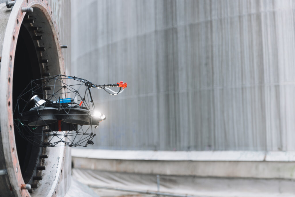
The new payload for wall thickness measurements The Challenge In the process industry and tank terminals, wall thickness measurements need to be regularly conducted for statutory inspections or inspections. To perform these thickness measurements (TMLs, Thickness Measurement Locations) or corrosion investigations, these locations need to be accessed quickly but safely to avoid jeopardizing the continuity […]
Precision Elevated: Skyebase Delivers Unmatched Concrete Inspections with Spotscale’s Redetect AI Technology

Spotscale: Pioneers in Algorithmic 3D Data Processing Spotscale is at the forefront of transforming drone-captured imagery into intelligent 3D data. They are renowned for their proprietary 3D and AI processing technology that delve deep into visual data to extract critical insights. Their Redetect capability is a prime example of this innovation, specifically tailored for the […]
SkyeBase develops autonomous drone inspections for complex urban environments with the support of the City of Antwerp

As part of a call for innovation from the city of Antwerp, SkyeBase is launching an ambitious project on autonomous drone inspections. With the financial support granted by the city, SkyeBase will be able to develop a system that automates inspections of buildings and infrastructure. “We strongly believe in innovative projects that make our city […]
Vinçotte & SkyeBase join forces to offer innovative drone & robot inspections
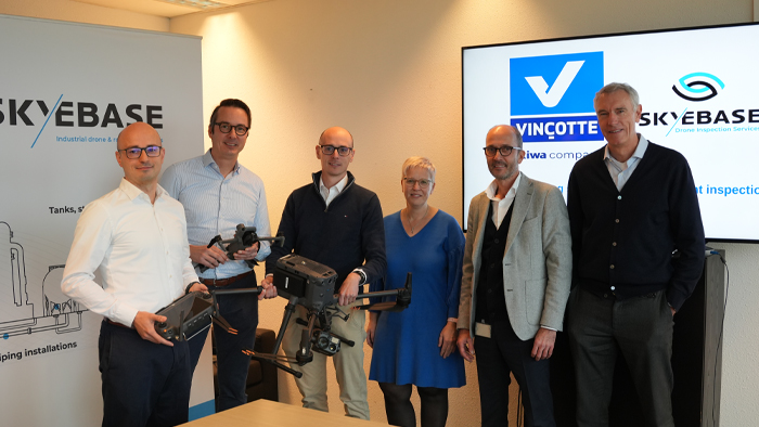
Industrial challenges The inspections industry faces a variety of challenges – think asset downtime, safety risks, a shortage of technical staff and a lack of insights for preventive and predictive maintenance. The consequences are often significant: after all, unplanned downtime means higher costs, reduced efficiency and increased safety risks. These challenges are especially prevalent in […]
SkyeBase Secures Prestigious LUC, Raising the Bar for European Drone Operations
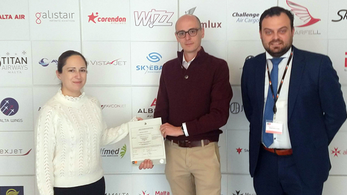
The LUC represents the highest level of certification in the EU for drone operators working within the Specific Category, which can include operations that may carry moderate to high levels of risk, such as flights beyond the visual line of sight (BVLOS) or above populated areas. By achieving this certification, SkyeBase has proven that its […]
The SkyeBase inspection approach
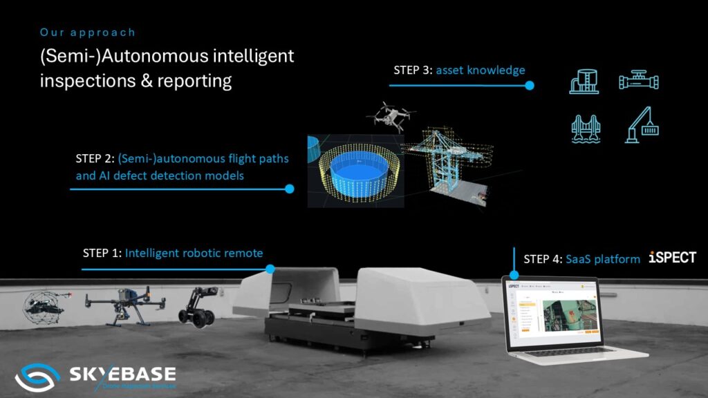
The SkyeBase inspection approach At SkyeBase, we work with our own unique, integrated total solution approach. So, how does that work in practice? Every project begins with carefully mapping out the inspection scope. Once that is done, we determine which intelligent drone, robot, or handheld inspection systems are best suited for the job. We then […]
The USAF resolution test chart
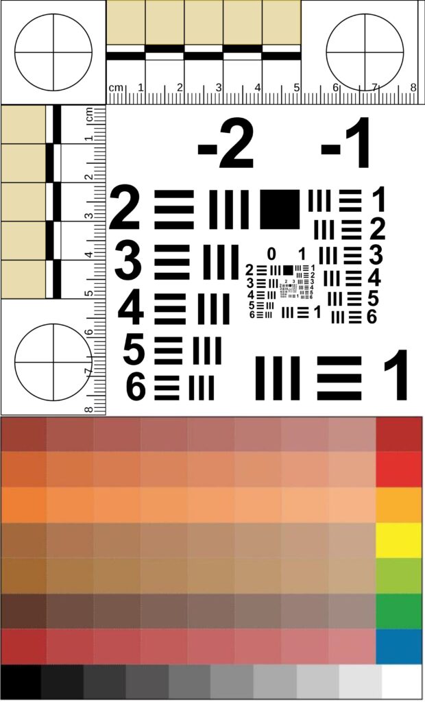
Quality of visual information via USAF 1951 Drones are being increasingly utilized for inspections, transportation, and security. They capture large volumes of data and there is a frequent question of whether a drone inspection can be considered equivalent to a visual inspection by the naked eye. A crucial aspect of drone technology is the quality […]
UT Measurements
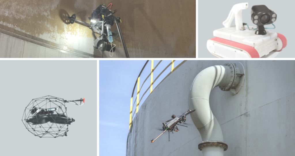
UT Measurements THE CHALLENGE In the industry, wall thickness measurements need to be conducted regularly for statutory testing or inspections. To perform these thickness measurements (TMLs, Thickness Measurement Locations) or corrosion surveys, these locations must be quickly, yet safely, accessed to avoid jeopardizing the continuity of the (production) process. Specifically, for TMLs that are difficult […]