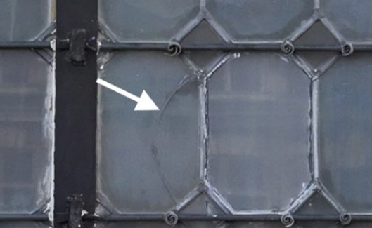
Orthophoto
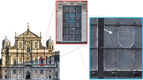
An example of an orthophoto of the front facade of a church. When we zoom in,
we can see damage on the stained glass window, allowing us to pinpoint its exact location.
THE CHALLENGE
After conducting an inspection with drones, we have a lot of individual (detail) photos. Such individual detail photos lose a lot of contextual information: Where is this damage located? How extensive is the damage? Are there any peripheral factors causing the damage? Is there a pattern in the damage? All these questions can be more easily answered with an orthophoto, providing a lot of insights.
THE TECHNOLOGY
An orthophoto is created in post-processing by merging different individual photos captured in a predefined manner. These photos must be of high quality and taken with sufficient overlap so that the software can merge them flawlessly. Through photogrammetry, these photos can then be composed into an ortho mosaic or orthophoto.
An orthophoto is essentially a photo that has been processed to look as if you are viewing the earth directly from above. This means that all distortions typically present in a regular aerial photo have been removed. This allows you to use the photos as if it were a map, enabling precise measurements of distances and areas. It is thus a very useful tool for urban planning, surveying, or map-making. The same principle can be applied to vertical surfaces, making it a very useful tool for indicating defects.
With artificial intelligence, in some cases, defect evolutions can be visualized. More information on this can be obtained upon request.
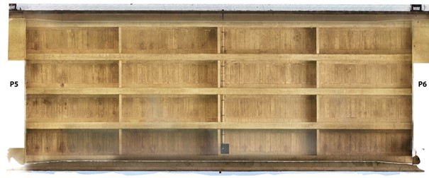
An example of an orthophoto of the underside of a concrete bridge deck.
THE BENEFITS
Using an orthophoto offers several advantages:
- Overview: One image speaks louder than 1.000 individual photos. It helps all stakeholders in a project understand what it entails, where it is, and the extent of a problem.
- Detail level: Because all distortions are removed, an orthophoto is much more accurate than a regular aerial photo. This makes it easier to make precise measurements, such as determining distances and areas, as well as detecting any defects, damage, or structural issues in buildings. The level of detail depends on the flying distance and the chosen camera.
- Compatibility with maps: By measuring ground control points, the orthophoto is georeferenced and can be linked to map material. This makes it easy to combine and analyze different types of information.
- Operational impact: Since the analysis of an orthophoto occurs after data collection, it is relatively quick. This results in low operational impact.
- Comparison over time: An orthophoto captures a moment in time. By regularly capturing orthophotos, inspectors, with the help of AI, can detect changes over time, such as cracks getting larger, movement of structural elements, or aging of materials. This enables planning for preventive maintenance and addressing potential problems early.
In summary, orthophotos captured with drones are a valuable tool because they provide detailed visual information, improve safety, save costs, and increase the efficiency of inspection processes.
EXPERTISE
Completed projects of using orthophotos can be found here:
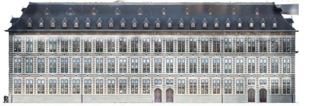
Example of an orthophoto of a building.
Share:
